Saturday, October 27, 2012

High on Adventure, Low on Quality (Mt Robson, Wishbone ArĂȘte)


"It's the worst route I've ever done."  Was Canmore local, Nancy Hansen's summation of her experience on the Wishbone Arete on the South Face of Mt Robson. This, coming from a very accomplished alpinist, who is the 1st (and only, I think) woman that has climbed all of the 53 peaks in the Canadian Rockies that stand over 11,000'. I'm not positive on this, but I think that less than 10 other people in the world can boast the same. So that report, coming from her, hit hard. In fact, her and her husband, Doug, were climbing the fifty together too, and a failed attempt on the Wishbone made Doug drop the pursuit entirely. He said he never wanted to get back on that awful route. We had traveled a long way to try this mountain for the third time, so these heavy, first hand accounts, made my stomach turn.
In 2010, Janelle and I hiked to the Forester Hut, only to be turned back due to warm temps, and utter intimidation. Last summer we made the journey again to, "check things out". There was way too much snow on the rock sections, and the rime-ice gargoyles were even bigger than the previous year. So instead of climbing, we decided to run to Berg Lake, to scope out an alternate approach to the Wishbone Arete. 24 miles later our spirits were not boosted, as we found no easy ramp system that would put us near the base of the route…or anywhere close. Now, in 2012, we were ready to give 'er another try.
As we drove north on the Icefield Parkway, after talking to Nancy, the conversation was as lively as a cemetery. It seemed like Janelle had already mentally thrown in the towel. Me, the stubborn one, tried desperately to find the bright side of this dimly lit situation. "Well…at least after climbing the Wishbone, every other route we climb the rest of our lives will be better." Silence. "Just think, we are going to climb the worst route in the Canada, and maybe the world. The worst! That's kinda worthy right?" More silence. Things were not looking good. I resorted to changing the subject to the amazing views unfolding through Lulu's windshield.

Pulling into the visitor center, just off the highway, one is slapped in the face with Mt Robson's South aspect shooting 10,000 feet from the valley to the summit. It is the most impressive roadside mountain view I've ever seen. Janelle drug her feet getting out of the van. "Come on, lets go check the weather forecast, it will probably be crap anyway, so we won't have to climb." The door opened, and she got out.
The forecast is posted on the main entrance. Clear and sunny across the board. Crap. No excuses now. We then drove down the road to Valemount, where our friend, Reiner Thoni, lives. Reiner was letting us borrow a couple bikes, allowing us to turn the 6 kilometer (4ish miles) hike into Kenny Lake into a ride. His parents own and operate the nicest restaurant in Valemount, the Caribou Grill, and we had been invited to stay with them while in the area. The upper floor of their home is the restaurant, and the bottom floor is their living area.
In the parking lot we went to work. Janelle prepped the food and I prepped the gear…in silence. The following morning we woke early and started the journey.
As we pedaled along light rain fell, so much for the forecast. At Kenny Lake we stashed the bikes in the woods, and continued several miles to the ranger station located in the Valley of 1000 Falls, where we asked the ranger for a conditions report. She did not have good news. They had had record snowfall this past winter. Record snowfall equals record run-off. The river we had to cross was still in its flood stage, oh, and the water was about 38 degrees! We had not brought running shoes, which meant a barefoot crossing. The stoke sank even lower. A few more miles brought us to another ranger, a twenty-year veteran. He confirmed the bad news, and piled more on. Things were grim now. On the creek bank, where the normal creek crossing is, we stood and looked across 80 feet (24.39 meters) of fast flowing, liquid ice water, roughly waist deep. I’m stubborn, but not that stubborn.
Throwing down the packs, we had a family meeting. Janelle, a chipmunk, and myself. The opportunist chipmunk said about as much as we did for the first five minutes. Mr. Chipmunk's cheeks were bulging when Janelle broke the silence, "Why do we have to climb this stupid route anyway. It’s totally not classic. Nobody ever climbs it, and the Kane Route is suppose to be way better."
Long story short, we set our sites on the Kane Face Route, which was another 6-7 miles (10-12KM) up the trail.
 Short story shorter, the lack of freezing temps turned us around at the base of the Kane Face the following day, and we walked all the way out. I was totally bummed, and Janelle was totally over trying to climb this scary mountain that is really not that classic. The stoke was at an all time low. That is, until we met back up with Reiner.


Reiner has a pretty cool thing going in Valemount, BC. For three months he works non-stop planting trees in the rough clear cuts. He makes enough during that time to, more or less, float the rest of the year. He ski tours non-stop, and is a very accomplished randonee racer. In fact, he is the fastest rando racer in North America. He is, what we call, good energy. After sharing our woes of defeat, he suggested that we just hang out a few days, pick some huckleberries, and turn our sites to the Japanese Route on Mt Alberta. He wanted to climb this with us. So that’s what we did. [I’ll write about the Mt Alberta experience at a later date.]
Fast-forward 8 days. The sun is still shining, and we are back on our bikes heading again to Kenny Lake, with Reiner leading the way. The hike up to the Forester Hut, which took us 8 hours in 2010, took us only 4.5 hours this time. We got to the hut without a hitch and started packing for the following day. The forecast was amazing, so we decided to par down our kit even more. Opting to take only one sleeping bag, one pad, and a little Nemo tarp for a tent. There were a couple other guys at the hut, who snored, so we slept under the stars outside the hut.
The alarm went off at 3:30, and we were en route a little after 4. That far north, in August, daylight starts early. We picked our way along the yellow bands by headlamp. After an hour we had already past our 2010 highpoint, virgin terrain from here up. We were all moving well, full of energy and a combination of nervousness 
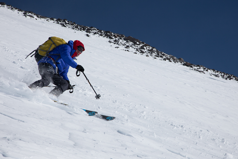
and excitement. Staying unroped to move quicker, we scrambled up the first few thousand feet in only a few hours. The macro route finding was easy, as this is a ridge climb. The micro route finding, on the other hand, was a different story. Finding rock that actually stayed in place was a real chore. We climbed side-by-side when possible to avoid sending rocks on one another. When the rock got steep, we threw the rope on and I led a couple pitches of "5.7 dangerous". Then back to un-roped terrain.
The heavy snow that made the creeks impassible, a curse for that approach, where now a blessing for this route. A snow coulior was still intact just to the right of the ridge. Jumping on this firm snow, we got a needed break from the loose-nasty rock. The ice had some spice, several big rocks fell above and picked up speed on their way down the 65 degree snow slope. Climbing quickly, and looking up constantly was our only defense. This snow section took roughly an hour. It was a big aid in our upward progress, as the rock to our left and right looked especially loose and steep.
 Back on the rock above the coulior, we took a break in what was obviously a bivy site. This is where Reiner found an old plastic tube with a metal screw-top cap. The clear plastic tube was cloudy from what looked like decades of Mt Robson abuse. Inside was a little wishbone, and a dried apple core. Curiosity led us to open the tube (it broke easily while trying to unscrew the lid). Inside was a little pencil, a chicken wishbone, silver and orange paint chips, and the apple core turned out to be a rolled up damp note! Concluding that the note would be worthless if we left it there, Janelle tucked it into her pack. We left the broken tube/cap and the wishbone right next to several rusty tuna cans. Maybe if someone is up there epic-ing they can get the calories they need by chewing on the bone marrow of the wishbone?!


The rock ended, and we were back on snow. Simal-climbing ticked off several more thousand feet. The slope got steep and we switched to climbing in pitches. I was nominated to be on the sharp end. It seemed like we were just a stones throw away from the summit, but our altimeter watch kept things honest. We still had about 800 vertical feet (240 meters) to the summit. 

Not wanting to mess with the super scary Patagonia-like rime-ice gargoyles I traversed to the west side of the ridge, looking for easy passage. Four traversing, slightly rising pitches later I started straight up the 60-70 degree snow slope. The beautiful sunny day had softened the snow considerably. I had to move slowly to ensure I didn't fall. Once out of rope I dug into the snow to build an ice anchor. This was worthless. There was no ice. I dug my tools deep into the snow, made a butt bucket, sat in it, kicked my feet in, and put Janelle and Reiner on belay off my harness. They quickly climbed up my foot buckets to my lame anchor. "Sorry guys, no ice." Sobering looks all around. They kicked in, drove their tools into the soft snow, and I launched for another pitch. When I was 70 feet out with no protection, Janelle looked at Reiner and said, "You can unclip from me if you want? No sense bringing us all down if Mark falls." He laughed, and stayed connected.
I made it up to the severally corniced ridge, and looked down the other side. This was epic! It didn't look passable, and I started looking around for a good way to anchor myself to go back down and try a different way. No ice here either. This was becoming an unfortunate trend. The sun was now well on it’s way to the horizon. A prompt decision had to be made. I hopped up on this knife ridge of snow. If I was cool like John Wayne, in that moment I would have likely tipped my hat forward, looked boldly into the camera and said something macho like, "Giddy up" as I saddled up on the snow ridge. Instead, since I'm just Mark, I said "oh please don't break, please don't break" many times as I crossed the ridge onto the other side.
Now on the shaded east side of the ridge I was able to find ice! I placed a screw and a couple really crappy cams, and shouted "OFF" into the wind. Janelle and Reiner came up, saddled up, scoochted across, and climbed over to me. "Wow, that was really hard, nice work Mark." "Thanks, but its not over yet," I said. Above us was an even steeper snow face. We were smack in the middle of the Gargoyles now. I was able to place a stubby screw four feet above the anchor before the ice disappeared.
I had just entered unknowingly into the zone of vertical trench warfare. Every step took 12-15 foot kicks, needed to compact the snow. This effort would advance my body roughly 3 inches (7.62 cm) upward. My arms "windshield wiped" the loose snow in front of my face. Gravity took hold of the dislodged snow and it fell thousands of feet down the slope. I then buried my arms and tools up to my armpits to get some sort of purchase. These "handholds" held so long as I only pulled less than 20 pounds (9.07 Kg) of pressure on them. Then it was back to my feet. Sweep the area with my knee to clear snow, kick 12-15 times, commit to that new step, back to the arms, clear snow, bury arms, twist tools, and repeat...1000 times. This took me to the top of the first Gargoyle. More of the same for a total of 180 feet (50 meters). When I finally pulled through the vertical onto the slightly-less-than-vertical I was so relieved. I could now get great foot and tool purchase, so I yelled down for them to simal-climb. I had to make it to the other side of this last snow ridge so I could give them a proper belay with a good braced terrain anchor.
Twenty minutes later Janelle's head poked over the ridge I was belaying behind. Her eyes were wide. "Mark, where did that come from?! That was insane!" "I know right." Now, we were a stones throw away from the summit.
The next image will be forever burnt in my brain. Janelle and Reiner took the lead walking on a rib of clean snow to the summit of Mt Robson. The sun had set and the twilight was surreal. Brilliant purples, reds and blues lit the background in a way that I hope heaven is like. Their bodies were dwarfed by the huge views that wrapped around us.
On top I quickly changed my wet clothes for dry ones, put on all my layers, and we headed down. Darkness turned on us about 500 feet below the top. We were back seeing only what our headlamps could reveal, which wasn't much. Not wanting to cross under the seracs in the dark we dug a snow cave and shivered for 4 hours until the sun came up again.
Crossing under the Schwarts ledges is scary. The Schwarts ledges are formed by the edge of the glacier coming to an abrupt end directly above a 200-foot rock cliff. This forms a 180-foot tall ice wall, that cleaves off on a regular basis. One must walk on the rock, under the ice face, in order to get past this section. I don't know why this is a route up this mountain. Don't ever try this in the dark, or at all. I have never had to roll the dice in the mountains like this. Thankfully we were only exposed for about 10 minutes, but in my mind that is 10 minutes too much.
Back at the hut we lounged around, soaking in the victory. Someone had photocopied the Alpinist article about Robson and left it in the hut, which I started reading. The Wishbone ArĂȘte had a page dedicated to it. I freaked out when it mentioned that second party to attempt the route (unsuccessfully) had left a silver painted chicken wishbone at their highpoint. "DUDE! We found their wishbone!" It had been left there July 24, 1951. So cool! Reiner took the note to the mountaineering museum in Valemount, and the wishbone is still up there. Thankfully, I never will be. Every other route I climb for the rest of my life will be better than that one. Now that's something to be pumped about.


Check out the video of this climb: www.smileysproject.com
'Like' the project's Facebook Page for live updates: http://www.facebook.com/SmileysProject

Video will be posted on Tuesday Oct. 30, 2012

Tuesday, August 14, 2012

Down is Way More Fun


Standing on top of one of the seven summits is a goal sought after by people the world around. At 20,320 feet, Denali, aka Mt McKinley, is North America’s tallest mountain. Some claim that it is more difficult to climb than Everest. This is likely due to the heavy packs, deep snow, lack of Sherpa support, and arctic temps. Since I have not yet climbed Everest I cant confirm that claim, but I do know that climbing Denali is very difficult.

Janelle and I “bumped” from the Tokositna Glacier directly over to the Kahiltna Glacier after our successful climb of Mt Huntington via the Harvard Route. That climb took 3 days, followed by 4 days of waiting on clear weather to fly, so we still smelled relatively fresh, at least by Denali standards.
Our 4-day bad weather nap on the Tok left very rested, and a little antsy to get going. Two hours after landing at the Kahiltna basecamp we were moving our huge sleds to Camp One, located 5.5 miles away at 7,800 feet.
 Skiing makes the experience of hauling heavy loads way more enjoyable. Skinning up the gigantic Kahiltna Glacier by the light of the midnight sun was amazing. It was almost beautiful enough to take our minds off the collective 300lbs of equipment trying very hard to crush us. Three hours of brut hauling later we arrived at camp.

The next morning we carried half our kit up Ski Hill and beyond, to the 11K’ camp. This took 5 hours. After burying those supplies three feet under the snow, and GPS waypointing its location for easy retrieval, we skied back down to 7,800’ camp...in 10 mins!

Two days later we were ready to schlep our loads from the 11K’ camp to Windy Corner. This requires going up Motorcycle and Squirrel Hills. Motorcycle Hill would become the site of the fatal avalanche that took four Japanese climbers’ lives while they descended this slope two weeks later. Trying to haul a sled and a pack up the hill proved to be impossible, and extremely frustrating, with the two feet of fresh snow that had fallen the previous day.

Deep fresh snow makes for horrible climbing and great skiing, so we decided to ditch the sleds, and skin to the top of both hills carrying only our packs. Then come back and get the rest of the load later. The best part is that we got to ski down in between loads. All told we climbed and skied this part of the mountain four times. The “quad-carry” is definitely the way to go…with deep snow and fun skis.

On day 5 we arrived at 14 Camp (located at 14,200 feet). This high altitude gypsy tent city is quite the anomaly.  There are roughly 150 people from all over the globe, congregating in this barren beautiful white frozen patch of snow. Everyone has fortified their plot of snow with large ice block walls. These walls help prevent the neighbor’s dog from crapping on your lawn. They also serve as wind blocks, so your tent doesn’t break during the huge storms that sweep the area on a regular basis.

It’s easy to spot the civil engi-nerds among Camp 14’s tent city, as their walls are constructed perfectly, with ice blocks fitting together to create airtight fortification. Once our little campsite was constructed we rested. About that time the routine of living on Denali set in hard and fast. The routine looks something like this.

9:00AM: Bladder screams you awake. Answer the call, using the brimming pee bottle. Still below freezing, so its back in the sleeping bag.
10:45: Cold water droplets hit face every 30 to 60 seconds, caused by the melting hoarfrost that built up on the inside of the tent.
10:50: Get fed up from the Chinese water torture. Put on a flock of down, go outside.
11:15: Breakfast time: Hot cocoa, pancakes (“bootied” from a group descending), bacon. All cooking done in the kitchen tent, which then becomes the hang out tent.
11:50: Poop in a plastic lined 12-inch tall green plastic can, hoping that a ground blizzard doesn’t pick up and freeze your bareness while squatting over it.
12:00: Hang out in the cook tent, shooting the bull with new friends, talking about the weather, other climbs around the world, and playing the game called, “have you seen that youtube video where…”
2:30PM: Go for a ski tour just outside of camp, sometimes with climbing gear, sometimes without.
5:00: Lunch time: Cheesy Quesadilla, with salami and mustard…add guacamole on special days.
5:30: Walk around camp, meeting those that just arrived.
8:00: Card games in the neighbors cook tent.
10:00: Dinner time: you name it, we ate it.
12:30AM: Feet are now too cold to have fun anymore. Crawl in the tent and watch 2-3 episodes of The Office on the ipad until the screen frosts over.
1:45AM: Still not dark outside, but go to sleep cause that’s what you were suppose to do hours ago.

This rock and roll lifestyle went on for days and days. When the weather was nice we would escape uphill as high as possible to help the acclimatization process. You see, we needed to prepare our bodies for the thin air little chunks at a time. All in preparation to climb the Cassin Ridge as fast as we possibly could.

We went to 16,200’, then again to 15,500’, and finally to 17,800’ before a four day storm locked us down. We felt stronger each day, so logging the time at the higher elevations was working. Our plan was to summit and ski the West Buttress, then rest for 2-3 days prior to going up and over to the Cassin.  Our time was limited, so things had to line up pretty perfectly to make this plan successful.

The morning of July 16th had blue skies and little wind in camp. We packed our bags quickly and headed up the trail that had been beaten in by the 50 climbers in front of us. Since we were on skis, and only had daypacks, we were able to pass everyone before reaching the fixed lines on the headwall that takes you from 15K’ to 16K’.  We put the skis on our packs, strapped on crampons and ascended the wall.

Pack weight is a huge part of moving fast in the mountains. We only carried two types of items, ingestibles and warm clothing. We left the rope behind, which upped the risk factor, but saved 8lbs of weight.

At the 17K’ camp we stopped in a friend’s kitchen tent for a 30 minute break to warm up, lube up, and bundle up. Denali Pass was next.  From there up it is traditionally much much colder. Once we rounded Denali Pass the winds from the North picked up, forcing us to cover all exposed skin. I wanted to switch my sunglasses to goggles, but did not want to take the time needed to get in my pack and put them on. Instead I pulled the drawstrings tight on my hood, faced down wind, and kept plodding along.

We reached the summit around 5:00PM, 7 hours after leaving 14 Camp. It was cold, windy, but relatively clear and amazingly beautiful. Probably the most beautiful part was that we still had the skis on our packs, and they were about to go on our feet! The most novel part about ski mountaineering is that it turns the worst part of climbing into the best part….the descent.

The snow was bulletproof wind-blasted nastiness from the top to about 19K’. It’s the kind of skiing that can make your fillings fall out. We would take three to four turns then have to catch our breath for half a minute. The skiing wasn’t great, but it sure beats walking. The best snow we found on the Phantom Wall, which rises above the 17K’ Camp. Turn after turn we cut up this slope. The air was getting thicker, the views were amazing, and my altimeter watch was having trouble keeping up with the speedy descent.

We stopped briefly at the 17K’ Camp to chat with friends, then walked down the West Buttress to the top of the fixed lines. There was more good snow to be found here, all the way back to our tents. We were tired, but grinning, as we crawled into the bags that night. We had just skied the West Buttress from 14 Camp in a little less than 12 hours.

The following two days we rested. I thought we would bounce back quicker than we did. The two nights after the summit push we packed our bags for the Cassin Ridge. Things were not looking that great, but we were going to be ready if they changed.

That night we set the alarm for 4AM to give us plenty of time to get started on the route. At 3:30AM what felt like a significant earthquake shook us awake. This was followed by serac fall. Scary. Then the wind picked up, and it started snowing. Things were not looking good.
In the mountains it is very easy to make a host of sound excuses not to put your body through more physical and mental exhaustion. I think we had a number of really good ones, which lead us to become part of the statistic stating that 90% of climbers who register to climb the Cassin Ridge never even get on it.  Next year I hope things are different.

Alaska 2012 was a great experience for us. Climbing the Harvard Route on Huntington was the highlight for me, and skiing for the summit of the highest point in North America was a close 2nd.

Thursday, July 5, 2012

Soul Destroying Wallowing Up Mt Huntington

Near the top of Mt Huntington
There is nothing like a big mountain in Alaska to motivate one to train hard throughout the winter. Janelle and I punched the workout clock on a regular basis the last 6 months, making sure that we arrive at Big Snowy in prime time condition. Nordic skiing, backcountry skiing, ice climbing, guiding a Peru expedition to climb 18K’ peaks, and several rando races where all on the menu.

Living in a ski town allowed for easy access to the backcountry, which was our preferred workout routine. Probably the best part about ski touring 8,000 vertical feet in one day somehow turns an entire package of Oreos into a single serving (yet another example of the human mind having the ability to rationalize anything).

We moved out of our rental in Crested Butte at the end of April, back into our van, Lulu, which is now our only home. Are you considered “homeless” if your place of residence gets 20 miles per gallon?

Wanting to be as strong as possible for Alaska, and wanting to have a little bit of summer prior to being locked in the glacier icebox, we headed first to Indian Creek. The climbing there is never ending, and no matter how many times we visit it seems as though we have barely scratched the surface.
Janelle climbing in Indian Creek, UT Super Crack area
Indian Creek was followed by two 50 Classic busts. We tried unsuccessfully to get permission to climb Shiprock, and got frozen off the Petit Grepon in Rocky Mt National Park [we are going to keep knocking on the Najavo Nation door until permission is granted]. Wanting to lick the wounds of my pride by getting to the top of something, anything, we pointed Lulu north to Washington State.
Descending Eldorado Peak, North Cascades, WA
Here we had great success with the two-week high pressure that settled in over the state in May. We completed the Forbidden Ski Tour, skied Eldorado Peak, and skied Mt. Shuksan. Come to find out that both of these ski descents are in Davenport’s book, “Fifty Classic Ski Descents”….the next project maybe?! Both descents are super worthy.
Jon Swain ripping it down the summit coulior on Mt Shuksan, WA
It was then time to make our final preparations for Alaska. Stuffing four duffle bags, each with 50 lbs worth of down products, sharp metal, and tons of camping gear, is quite a task. We did all this at Golden Gardens Park in Seattle, which borders the Pacific on a busy Saturday. I am proud to say that we made even the most seasoned Seattleite turn their head and stare, wondering what we were doing.

It’s a quick flight up to Anchorage where our good friend Bob Lohr picked us up.  This is the third year in a row he and his wife have extended their hospitality, and their Costco card, to us. With a packed SUV we headed further north to spend time with Janelle’s maid of honor, her husband, and their three kids. Any curiosity the Seattleites had for what all our equipment was for what dwarfed by the amazing curiosity of 3-year-old Jeremiah and his little sister.
“Watts dis?”
“Those are skis, for going fast on snow.”
“Watts dis?”
“That’s an ice tool….oh, lets play with something else.”
“Watts dis?”
“That’s a ski pole, its for helping keep your balance.”
“Why?”
“umm….I don’t know how to answer that question.”

The thriving metropolis of Talkeetna (population 876) was full of tourists, and we were happy to add to that number. Weather delayed the flight onto the glacier a day, so we got to hang out an extra night, which turned out to be a great way to settle the nerves after all the luggage schlepping.

The morning of May 23rd was nice enough to fly. Amped, we changed out of our street clothes for our techy climbing clothes. The Tokositna Glacier is not nearly as popular as the Kahiltna Glacier, so we were in a plane by ourselves with none other than the owner of Talkeetna Air Taxi, Paul Roderick. He has been flying climbers in and out of the mountains for a long time and really does a great job.

On the glacier there was one one other party of two. We dragged our supplies 100 yards away from them and set up camp. The two other climbers had their sites on the West Face Couloir Route, and gave us a report that one other group had climbed the Harvard prior to their arrival, which was 10 days before now.

Mark climbing the first snow/ice section on Huntington
The following morning we woke at 7AM and were enroute around 8:30. The trail was kicked in to where the two routes diverge. Once on the fresh snow we sunk up to our knees and the progress slowed considerably. Moral was high so we put our heads down and pushed through it to the bergshrund, where we roped up and started simal-climbing. It really is amazing how quickly one can cover ground when not pitching things out. 3.5 hours of deep snow, a little ice climbing, and a lot of knee deep wallowing brought us to the base of the Spiral feature.
More simal climbing
This is the first of several mixed climbing pitches. M5 is the Supertopo rating. I don’t mix climb that much, so I was nervous. This was evident in the amount of cams I brought….many. Ditching the pack, I racked up and was off. There was a lot of snow covering the rock, which had to be removed. I hooked and pulled my way up little by little. Having a fifi hook was nice when things got cruxy. I would fifi into the highest piece, and start excavating snow and ice to get down to rock, hook my tools onto some stupid-tiny granite crystal the size of a pencil eraser, and pull up to the next placement.
Mark starting out on the Spiral section of, M5
The first anchor on the Spiral consisted of three old pitons at a hanging stance. More mixed climbing followed, which opened up into a 65-degree snow slope. The snow was fluffy, so I had to dig a vertical trench to make upward progress. This was both time consuming and exhausting. The heavy snow year covered up most of the fixed belays, so I dug for 20 minutes to expose a crack for an anchor, 195 feet above the last.
Mark aiding the Nose Pitch, C1
The next pitch was the most memorable. We took the farthest left of the three options listed on the topo. The asterisk on this option reads, “not recommended” due to hard mixed climbing on loose rock. This is where the large amount of snow was in our favor. It created an ice ramp on one side of this steep chimney, which I was able to place screws in the whole way up. With my back against one wall and four metal points biting into the ice on the other, I wormed my way up the 120ish foot pitch to a bolted anchor.
Hauling the packs on a frozen anchor
Two more snow wallowing pitches brought us to the Nose, it had been just over 13 hours since leaving basecamp. We were tired. Still more snow shoveling had to be done to make a bivy ledge. For weight savings we opted to just bring our Nemo Transformer Tarp as a shelter, and leave the proper tent behind. Rigging this to the bolts on the rock wall, and draping it over the snow walls Janelle created, was home for the night. It worked pretty well, but several snow spindrifts came in unabated by the tarp. The key to sleeping in this situation is to get really tired first!
Janelle high on Huntington
Unfortunately, the snow continued throughout the night. Not wanting to get avalanched off the mountain we reluctantly turned our sites downhill the next morning. We really dragged our feet making breakfast, as descending what we had just climbed was going to be no easy task. Around 10:30AM a pocket of blue sky passed over us. Shortly thereafter the snow subsided, and we decided to continue upwards. We had four pitches to get to the easy escape of the W. Face Coulior, which is what we descend if need be.
Janelle following the Nose Pitch
The Nose pitch is pure aid climbing. I was happy to have the experience gained by climbing the Nose in Yosemite to apply those skills here. It was straightforward C1 aid climbing up a 95-degree rock wall. Again the fifi hook was clutch. As I pulled over the slight roof my stomach dropped, this new 70-degree rock face was covered with 6 inches of snow and rotten ice. I had to excavate about 40 square feet of snow to get across to the where I hoped a fixed anchor would be waiting. I dug a while and revealed a fixed piton. This was like a treasure hunt. Making my way across this section took forever. I got to the anchor and had to chop at it for a while to extract the slings from three inches of ice. Janelle jugged the pitch, while helping push up the packs that I was hauling.

More trench warfare followed for another 400 steep vertical feet, where the West Face Couloir and Harvard routes merge. Our “trail” below looked like we just installed a half pipe in the side of the mountain. At this junction we were also able to look down the W. Face Couloir, which is thousands of feet of 50-70 degree perfect glacier ice. This would be our exit on the descent.
From here we had to go up 50 feet then down 80 feet, and traverse a scary unprotectable snow slope. The rock face we traversed beneath had no cracks for pro, but we survived.
Janelle 1500' below the top
Nearing the upper snowfield Janelle took the lead and punched a deep trail up and right, hacked through a corniced wind lip, and built an anchor in the rock. I took the lead on one more time consuming pitch which brought us to the point where it was a straight shot to the summit ridge. I was beat. Janelle was not. She unlocked this section, punching the route straight up to the ridge. We simal-climbed the whole way, literally taking one step up and 9/10th of a step back through the powder.

Near the top, we didnt take any "money" shots while on the summit
On the summit ridge it really started snowing, yet it was happy snow. That is to say there was no wind, and the flakes fell slowly to the ground. We pushed along the ridge until right under the final crux, an overhanging 40-foot wall of alpine ice. I dropped my pack, and went for it. It was pretty fun climbing this section, swinging tools on an overhanging ice wall, so close to the top of mountain in Alaska. How often does that happen?

A few hundred feet later we had run out of mountain to climb, it was 10:30PM. The snow had stopped and we had a semi clear view of the surrounding peaks, it was amazing.
Rapping down the West Face Coulior
The descent went smoothly as we were able to find ice for V-threads when we needed it. We rapped right down into the featured called the Cave, where we spent the night. The following morning it took us about four hours to rap down the W. Face Couloir and get back to the tent. The other group left V-threads all the way down the face, which helped greatly.

Back at camp, soaking in the victory
Back at camp we kicked off our boots, sat on as many pads as we could shove under our butts, and indulged in a lot of junk food. Alternating between salty and sweet food until our bellies were tight and happy. #36 was complete, and we slept with smiles on our faces. 

Monday, April 2, 2012

Clyde Minaret in Subwarm Temperatures


Clyde Minaret from the road

We knew that trying to climb an alpine route at 12,000’ in October was risky, but we wanted to squeeze every once of climbing out of the fall before winter locked its grip on the Sierras. Besides, the Clyde Minaret is one of the easiest climbs on the Classic Climbs list so we went for it, even though the forecast was calling for 30% chance of snow/rain.
The hike up to Minaret Lake passed quickly.  One hundred year old ponderosa pines, rushing creeks, and the occasional songbird that was hardy enough to make it through the Sierra winter occupied our minds during the hike. Dark clouds were ripping past the Clyde when we arrived. It made my fingers cold just thinking about touching that damp, 30 degree, shaded rock.

The next morning was cold, so we slept in. Eventually a few blue-sky sucker holes popped through the blanket of grey, which gave us hope and motivation to get out of our warm sleeping bags.

The mountain came in and out of view as we hiked to its base. Neither one of us said much as we crossed the mini snowfield, as we knew this was going to be a cold climb.  Not to say that climbing in the cold is as bad as sitting in city traffic, but we had been hoping that this “easy” classic climb would be warm and sunny as most other Sierra climbs tend to be.

We roped up and started climbing. Following the path of least resistance along the approach ramp, and then up into a huge dihedral. Thankfully we were able to climb the easier parts with gloves on, and still move quickly up the steep face. Occasionally the sun would break through and we would both stop to soak in the warmish rays.

The climbing was pretty good, a few loose rocks here and there, but a good climb nonetheless.  We made it to the top in a few hours, signed the book we found in the bomber metal summit register, and then had to decide how to get back down.

The topo suggested descending a couloir to the south, but we opted for the rappels to the north, as we did not bring crampons for the bulletproof snow we saw in the couloir on the way up. This descent was the highlight for me. We had to figure things out, make a couple of our own anchors, and chimney through the moat at the base, where the snow field pulled away from the rock, leaving a 20 foot tall hallway we had to pass through.

We got back to camp around six and decided to hike out that night, most of which we did under headlamp. It’s pretty nice to hike at night. The miles pass quickly. We made back to Lulu, drove back to Mammoth Lakes, and fell asleep quickly on a side road in the warmth of our nice soft bed in the van.

The Southeast Face of the Clyde Minaret is definitely worth the hike, but I recommend climbing it when the forecasted high is at least 65 degrees, instead of 40!


***To see the video from the experience visit: smileysproject.com ***